02_2004_spr_23_8
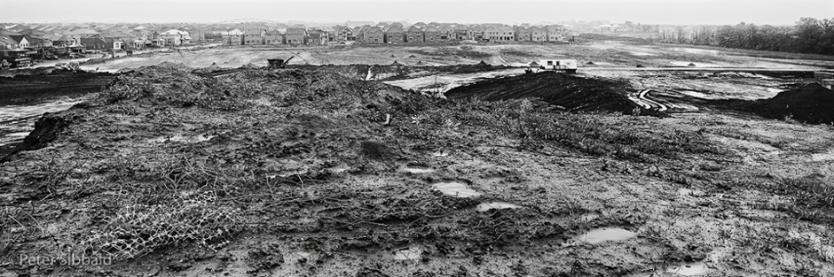
Markham, Ontario. As far as the eye can see
43°54’28.96″N 79°15’4.70″W, facing South-southeast, circa May 22, 2004
View from atop a 20 metre high mound of topsoil scraped from adjacent fields, formerly farmed by the pioneer families of James and Adam Clendenen, and of John Reesor. At a commercial topsoil producer’s operation, livestock manure is mixed with soil from the mound. Rain leaches pollutants from the stockpiled manure and the run-off flows unimpeded across the expanse of clay-laden subsoil into ditches leading to a nearby tributary of the Rouge River.
Recent Comments